| | |
 | The Grid Surface chart is a powerful way to display complex data using a surface with customizable elevation values for each data point. The chart is based on a rectangular grid, with X and Y coordinates defining the location of each data point on the surface. This makes it easy to visualize relationships and patterns in multidimensional data sets, allowing you to identify areas of interest and make informed decisions based on the results. With the Grid Surface chart, you can create visually stunning representations of your data that are informative and easy to understand. |
|
|
![wireframe surface chart]() | Wireframe Surface charts are a visually appealing way to display data in a three-dimensional format. The chart consists of a wireframe mesh that represents the surface of the data, with X, Y, and Z axes defining the location of each data point. This chart type is useful for highlighting patterns and trends in complex data sets, making it easier to identify areas of interest and make informed decisions. Wireframe surface charts are often used in scientific and engineering applications to visualize complex 3D data sets. They are handy for displaying large data sets that would be difficult to represent with traditional 2D charts. However, it's important to note that wireframe surface charts can sometimes be less visually appealing than other chart types, so it's important to carefully consider whether this type of chart is appropriate for your data set and your audience. |
|
|
![grid surface chart with texture]() | The Grid surface series offers a range of customizable FillEffect options for the surface, including images, gradients, advanced gradients, and patterns. Additionally, users can modify material properties such as Specular Color, Emissive Color, and Shininess to achieve their desired visual effect. With these powerful tools, you can create stunning, visually engaging surface charts that accurately represent your data. |
|
|
![grid surface chart projected contour]() | The projected contour chart is a powerful way to visualize data in three dimensions. This chart type is often used in scientific research, engineering, and other fields where complex data sets must be analyzed and presented clearly and concisely.
The contour chart is displayed using the Grid Surface Series in this example. The chart allows users to easily visualize the elevation values of their data points, with contour lines representing the changes in elevation across the surface. This makes identifying interest areas easier and analyzing the relationships between different variables. The chart can be rendered flat for a more simplified view or with actual surface elevation for a more detailed analysis. |
|
|
![grid surface empty data points]() | Empty data points is a feature allowing data points to be specified with no value supplied. These data points are not rendered by the chart thus allowing empty shifts in a dimension scale. |
|
|
![contour chart]() | This image demonstrates a contour chart displayed with the Grid Surface Series. The chart uses orthogonal projection with camera elevation of 90 degrees, the lighting is disabled and the surface is rendered in flat mode. |
|
|
![grid surface waves]() | Here the Grid Surface chart is used to represent waves. |
|
| |
Grid surface charts are a type of data visualization that represents three-dimensional data, where data points are organized in a grid.
The data points in each row and column in the grid share the same x and y values, whereas the z value is specified per data point.
A variation of the grid surface allows the user to specify a color for each data point thus adding a fourth dimension to the plot.
This type of chart is often used to visualize continuous functions or data sets that vary continuously across multiple dimensions, such as terrain data. |
X Value | Y Value | Z Value |
---|
0 | 0 | 2.2 | 0 | 1 | 1.8 | 0 | 2 | 1.4 |
The table contains data points represented by X and Y values indicating their respective positions on the chart. The Z value signifies the data value or elevation for each point. By utilizing this data, you can generate a Contour Surface Chart that displays contour lines indicating the value or elevation of the data at each point on the chart.
|
Surface charts are a great way to visualize data in three dimensions, making it easier to identify patterns and relationships. Here are some best practices for using Surface charts effectively:
- Choose the right type of data: Surface charts are ideal for visualizing data with three or more variables, such as temperature, humidity, and pressure. Make sure that the data you choose is appropriate for the chart type.
- Use appropriate colors: Surface charts can have multiple color schemes, and choosing colors that highlight the important aspects of the data is important. Make sure to use colors that are easy to distinguish and don't cause visual strain.
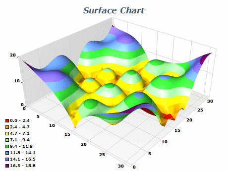
- Use appropriate lighting: Lighting can significantly impact the appearance of Surface charts. Use lighting that highlights the important aspects of the data, such as areas of high or low value that don't obscure any important details.
- Keep the chart simple: Surface charts can be complex, so keeping them as simple as possible is important. Remove any unnecessary elements that can distract from the important aspects of the data.
- Use appropriate labeling: Labeling ensures the viewer understands the presented data. Label the axes and provide a legend explaining the meaning of any color schemes used in the chart.
|
|